
Empowering Southeast Asia with location intelligence to drive smarter
decisions, sustainable growth, and digital transformation
Enable intelligent, connected, and safer fleet operations with our IoT and telematics
platform to deliver real-time visibility and predictive insights.
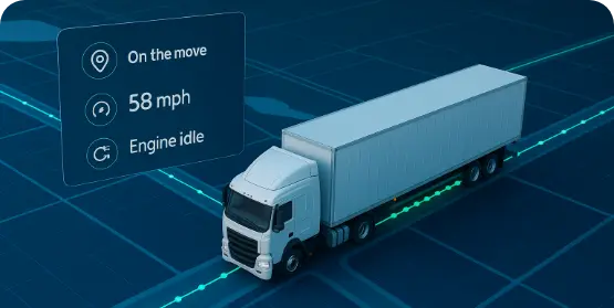
Gain complete transparency into your fleet with GPS-enabled telematics. Monitor vehicle location, status, and performance in real time—tracking movements, idle time, and on-road activity. This ensures smarter decision making, improved efficiency, and greater operational control.
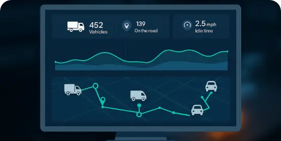
Unlock smarter fleet performance with real-time dynamic route optimization. By adapting to traffic, road conditions, and delivery priorities, your fleet automatically selects the most efficient paths—minimizing travel time, fuel use, and mileage. The result: lower costs, improved reliability, and a more sustainable operation.
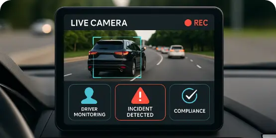
Boost driver accountability and road safety with intelligent video telematics. Vehicle-mounted cameras paired with advanced analytics enable real-time driver behavior monitoring, incident detection, and compliance tracking— ensuring safer operations and reduced risks on the road.
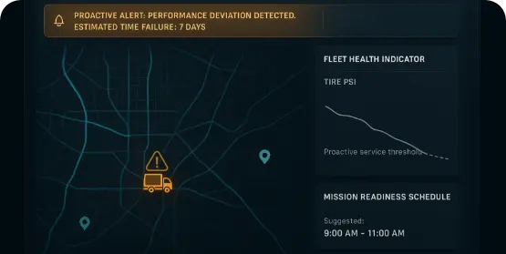
Receive proactive notifications on performance deviations and fleet health indicators. Schedule maintenance before issues escalate to minimize downtime and ensure mission readiness.
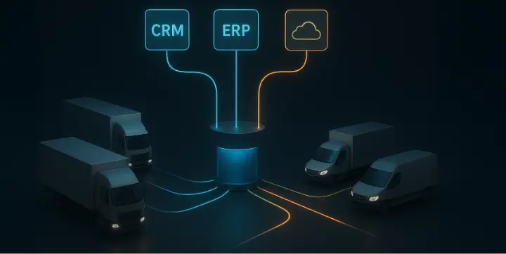
Our solution seamlessly integrates fleet management with CRM, ERP, and other core platforms through secure, high-performance APIs. The result is a unified data environment that drives insights, strengthens collaboration, and enables rapid, complexity-free scaling—keeping your organization aligned from operations to strategy.
Streamline field operations with location-aware intelligence & automation through our Workmate platform.
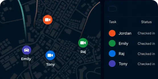
Track your workforce in real time with live location updates and geotagged check-ins. Managers gain full visibility into attendance, task progress, and field activity—ensuring accountability, preventing false reporting, and quickly spotting bottlenecks or inefficiencies.
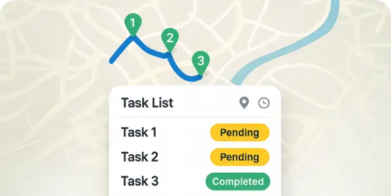
Assign, update, and monitor tasks in real time to match business needs. Built-in navigation and smart route optimization cut travel time, fuel use, and costs—allowing field staff to complete more tasks while management gains smarter planning and higher productivity.
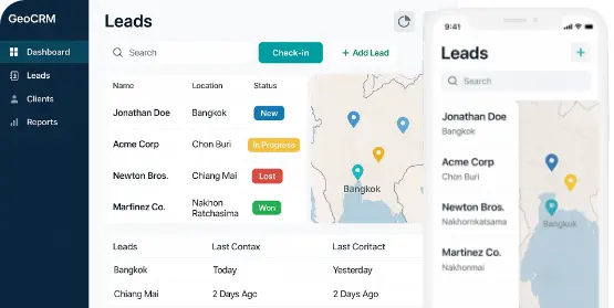
GeoCRM integration gives sales and service teams field access to customer data, nearby leads, and location insights—driving personalized interactions, higher conversions, and faster resolutions for a consistent, customer-first experience.
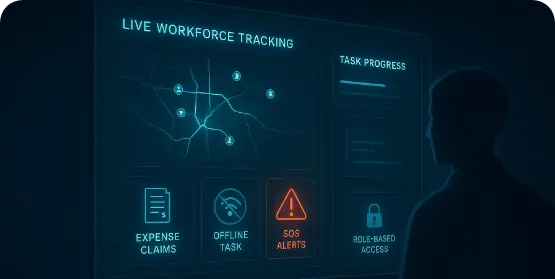
Equip employees with the tools to perform at their best while staying protected. Digital expense claims, offline task continuity, SOS alerts, and role-based access ensure smooth workflows, safety in emergencies, and minimal administrative overhead—creating a secure, efficient, and empowered workforce.
Leverage our mGIS and comprehensive solutions tailored for planning,
mapping, decision-making, expansion, monitoring, and emergency response.
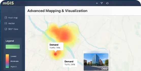
Turn complex geospatial datasets into intuitive, interactive maps. With heat maps, vector layers, and immersive 360°views, organizations can uncover hidden trends, visualize relationships, and make data easier to understand for both technical and non-technical users.
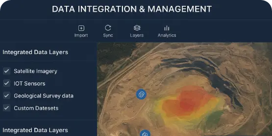
Seamlessly integrate satellite imagery, IoT data, government records, and custom datasets into a single, unified system. The platform ensures information stays accurate and up to date, helping organizations maintain reliable geospatial intelligence at scale.
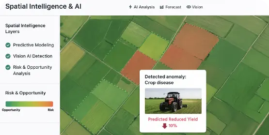
Leverage advanced spatial analysis, predictive modeling, and Vision AI to detect patterns, anticipate outcomes, and identify opportunities or risks. From urban planning to logistics and agriculture, AI-driven geospatial insights unlock smarter strategies and operational efficiency.
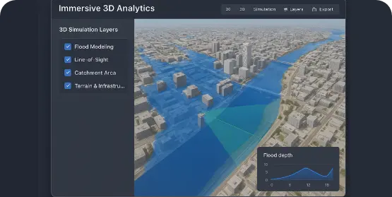
Go beyond flat maps with immersive 3D environments of terrain, cities, and infrastructure. Run advanced simulations such as flood modeling, line-of sight analysis, and catchment area mapping to plan with confidence and mitigate potential risks.