
High-accuracy maps designed for daily use, powered by
smart technology and hyper-local insights
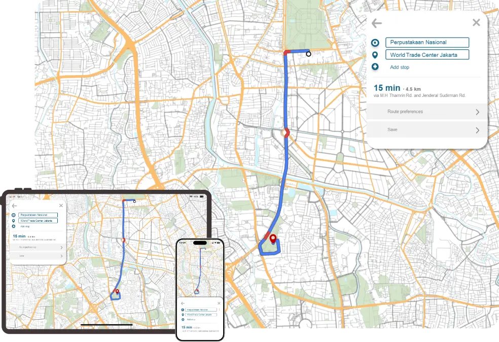
TLT Network data offers an extensive and highly detailed model of road, waterways, and railway networks.
Designed to be the core of any powerful routing engine, this layer is packed with critical details like road class, average speed and limits, direction of travel, turn restrictions, and lane count. It enables advanced, vehicle-specific navigation and provides the essential data needed to calculate the most efficient and logical routes, forming the solid foundation for your logistics, fleet management, or consumer navigation application.
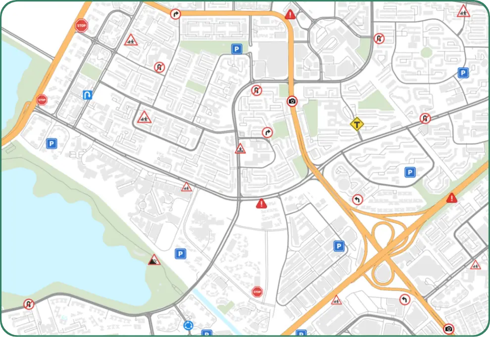
Our driver-alert offers 100+ proactive alert types from school zone, speed breakers, pedestrian crossings, to zigzag roads and many more for a smarter, safer, and more responsive drive.
TLT Signpost feature offers 350,000+ real-world signage, including route and exit numbers, street names, and place names, helping drivers align map guidance with actual road signs. Together, these features enhance situational awareness, reduce confusion on complex routes, and deliver a confident driving experience.
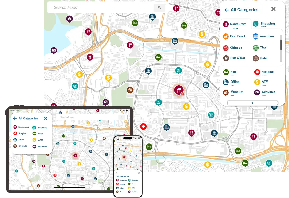
Over 10 million Points of Interest bring the map to life. This rich tapestry of landmarks and destinations provides constant orientation, turning the screen into a true reflection of the world outside.
A structure of 500+ clear categories makes finding any destination effortless. From the nearest ATM to a specific restaurant, what's needed is always just a tap away.
True power lies in the details. Each POI is enriched with searchable attributes for powerful, precise queries, and enhanced with local language names to deliver a seamless, intuitive experience for any end-user.
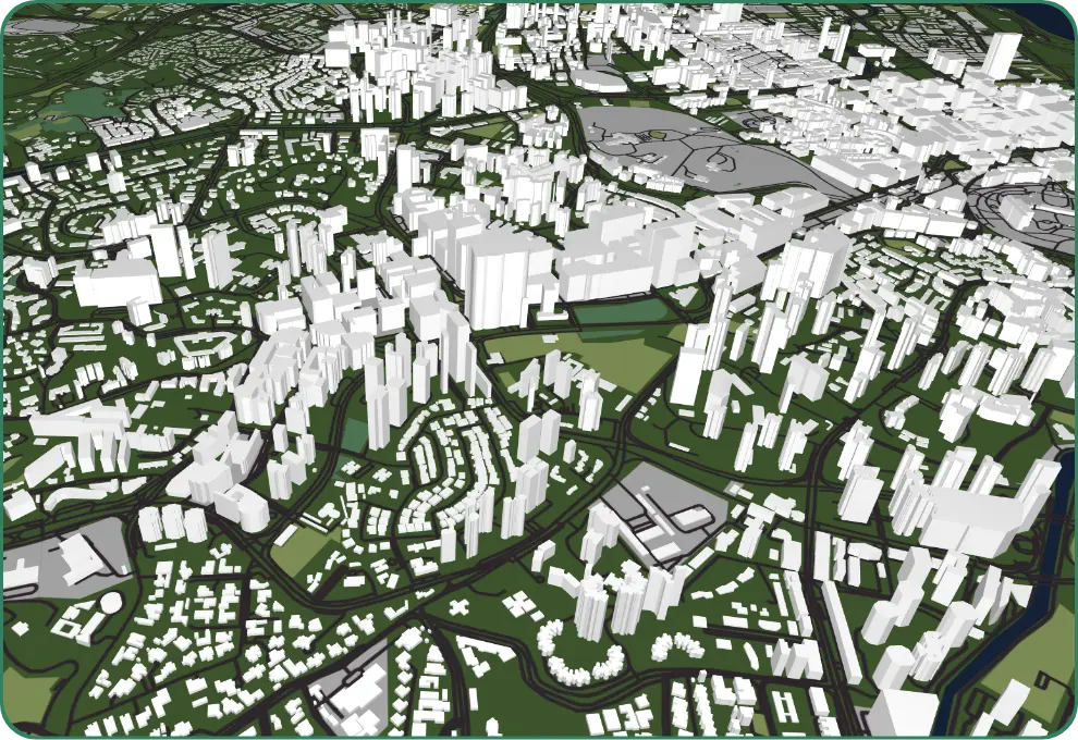
TLT delivers next-level map visualization and spatial awareness through highly detailed 3D buildings, realistic land cover, natural features—including oceans, islands, elevation contours—and signature 3D landmarks. These landmarks enrich navigation and exploration with lifelike realism, covering over 80 building classes such as airports, shopping malls, and cultural icons.
Our maps feature rich land-use representation across 40+ categories—from parks and rivers to residential zones— spanning major cities. With photo-textured 3D tiles and precision 3D models, TLT offers an immersive, real-world navigation experience that makes every journey intuitive and visually engaging.