
High-precision maps that enhance safety, intelligence, and more
predictive driving
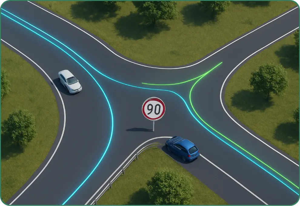
Our high-definition map data includes detailed curvature information, enabling real-time calculation of optimal steering angles. This allows vehicles to anticipate and navigate sharp turns and complex junctions with greater stability and control.
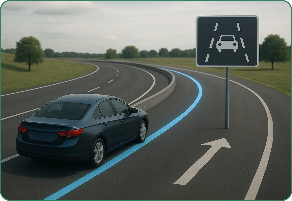
Our high-definition lane-level maps provide precise lane geometry and detailed road marking information. This data ensures vehicles remain accurately aligned within their lanes, enables proactive lane changes, and supports safe, efficient navigation—particularly in complex junctions and high-density urban environments.
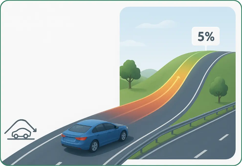
Our maps integrate precise slope and elevation data, enabling vehicles to adjust engine performance in real time. This ensures smoother acceleration on climbs, controlled braking on descents, improved fuel efficiency, and an overall more comfortable ride.
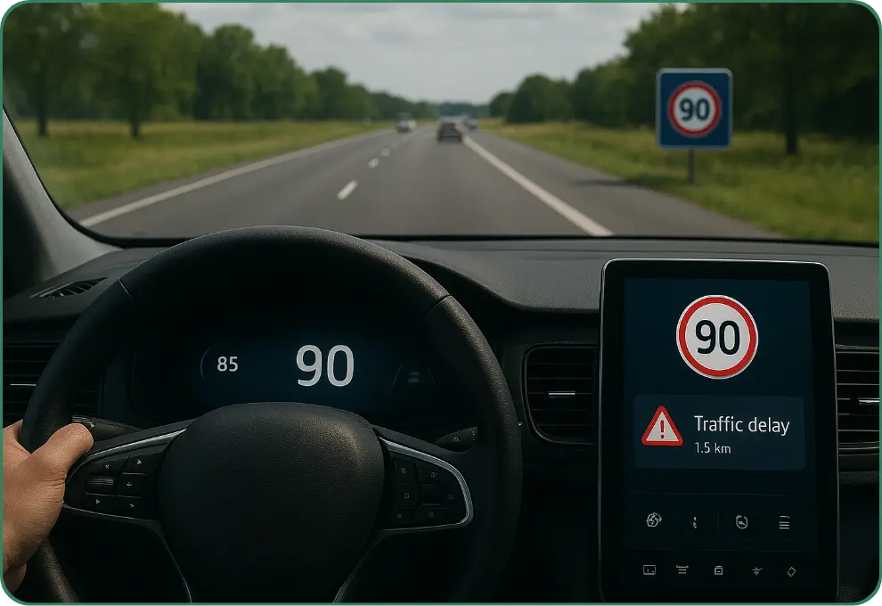
Leveraging real-time speed limits and detailed road attributes, our maps empower cruise control systems to automatically adjust vehicle speed. This predictive intelligence prevents over-speeding in regulated zones and delivers smoother, safer, and more efficient driving